We arrived in Mandeville a suburb of New Orleans on
Wednesday. We stayed at Fontaine Bleu
State Park. Our drive was very eventful.
To get to New Orleans, Louisanna we had to go through Florida, Alabama, and
Mississippi. It was a very cold, windy, rainy day. The winds were 112 kmh they
were strong enough to blow and break the Carnival Cruise ship’s ropes and it
went free. We got to see this in Mobile
Alabama as my dad was trying to keep us and the trailer on the road. We passed
over many bridges and bayou’s (French word meaning slow moving river).
Our first stop in Mandeville was at Louie and the Red Head
Lady a DDD(Diners,Drive-ins, and Dives) choice restaurant. We really liked
their bread pudding with toffee sauce and fried green tomatoes. There was a map
to show where people were from that had eaten at the restaurant and I made sure
to add a pin on the map to show Kilworthy.
On Thursday, we made a trip across Ponchartrain Bridge a 30
mile causeway to New Orleans. The buildings were a mix of new and old
architecture. We met one of my dad’s friends from highschool who is a professor
at a university there. We ate lunch on
Bourbon Street at Le Bayou. We had oysters, chicken and Andouille sausage
gumbo, crab chowder, shrimp Po boy sandwhich, Cajun jambalya, crawfish
etouffee, red beans and rice.
After lunch, we toured the street and went into a store that
had lots of beads, unappropriate shirts, dolls, masks, voodoo dolls and mugs.
We bought a mask, beads, and a doll for Grace. Next was our riverboat cruise
along the Mississippi River. It stopped
at the site of the battle of New Orleans. This battle was part of the war of
1812 between Canada and the USA. The battle was fought two weeks after the war
ended but the soldiers did not know that because they did not have cell phones.
This is a statue of General Andrew Jackson in Jackson Square. He was the US hero of the Battle of New Orleans because his troops killed, wounded or captured 2000 British soldiers while the US side only lost 20 men. He would go on to become the President of the United States and his picture is on the US $20 bill.
New Orleans and Louisiana Facts
Mardigras happens every year a big party that celebrates
food and fun. People exchange beads and listen to jazz music. Louisiana was
named after King Louis XIV. Louisiana is the only state to not have counties it
has parishes instead. Louisiana has a large settlement of Cajuns, who are
decscendants of the Acadians who were driven out of Canada in the 1700s because
they would not give up their French heritage and pledge loyalty to England. It
is the birth place of jazz music which led to blues and later rock and roll.
New Orleans is the second largest port in the US and the 3rd largest
in the world. The Fleur- de- lis is a popular symbol that is seen everywhere as
it is in Quebec.
This is us in line at the famous Cafe du Monde. Here they serve Beignets (you say it "Ben-Yay`). These are a warm white sugary donut. They are really tasty.
This is my new aligator head I bought on the way to New Orleans.
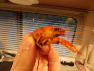
For dinner we bought fresh crawdads )like a mini lobster and shrimp that had just been caught. It is crawdad season right now in Lousiana.
All for now, off to Houston!!


.JPG)
.JPG)
.JPG)
.JPG)
